quarta-feira, 24 de novembro de 2010

António Galvão (1)

The most astonishing account of the world discoveries that survived to our eyes, is probably the one by Galvão (Antonie Galvano). We cite the 1601 preface to the translation of Discovery of the World, made by Richard Hakluyt, addressed to Robert Cecil, Earl of Salsbury, spymaster at the service of Queen Elizabeth I:
"The work though small in bulk contained so much rare and profitable matter, as I know not where to seek the like, within so narrow and straight a compasse".

Hakluyt seemed truly surprised and marvelled with Galvano's account... in particular he emphasizes the causes of the alterations of courses from East to West, and the ceasing of all traffic by the Goths invasion. This means that this information was kept secret in England, even to Robert Cecil, a spymaster... high rank English officials were starting to discover a completely different story. Some years after this publication, a civil war would be lead against the monarchy, by Cromwell. 

In Galvão you may found a consistent theory with statements of previous contacts between China, Europe and America. Some of these relations are now accepted, but most of them were lost in History books, some are made myths, or simply foolish theories - you pick!

King Tubal. Galvão starts to recall the Hispanic myth of King Tubal that in the year 143 after the Biblical Deluge travelled from the Caucasus to the Iberian Peninsula. This is quite interesting as the Caucasus may be divided in three regions, Colchis, Iberia and Albania. Colchis links to the east part of the Black Sea, Albania to west part of the Caspian Sea, and Iberia was in the middle… Mount Ararat is nearby, in Armenia.
Caucasus Kingdoms: a sketch in the “Atlas of Ancient and Classical Geography” by Samuel Butler

Colchis is associated to the trip of Jason and the Argonauts, searching the Golden Fleece of its King Aeetes (son of the sun-god Helios and of the oceanid Perseis). 
The association of the Caucasian Iberia and the Iberian Peninsula is only kept through this legend? 
It is worth noting also that Albania became a country located west, above Greece. These caucasian lands were later connected to the Alans that invaded the Iberian Peninsula in the 5th century AD. The name Lancaster was written in Portuguese as Alancastro, meaning “Castle of the Alans”… but this is a later story.
Galvão states that navigations already took place by the time of King Tubal. 
The name Tubal was associated to the portuguese city Setubal and nearby Troia (Troy, in portuguese)... until the XIX century. You may think that after the Spanish Inquisition, no such thing exists anymore, or you may wonder if a soft inquisition takes place - secrets are kept with intelligence... and agencies!
A work that is not known is not a menace, you just have to control the damage... if it happens to be known to a larger audience, you descredit them with a respectable academic lobby. You just have to wait, and people will forget about it.

Galvão also talks about the mythical voyage of the amazon queen Semiramis to Ethiopia and the defeat of an Indian King Escorobatis, with a fleet of one thousand ships, near the Hindu river. 

King Hispalo. Galvano continues, stating that by the year 650 after the Deluge, King Hispalo of the Iberian Peninsula sailed up to Cape Verde. He goes even further, saying that Gonzalo de Oviedo (in “Chronicas das Antilhas”) conjectured that Hispalo even went to the Antilles, and this was the reason why Antilles were called Hesperides in ancient times. He then relates in a subtle way the Atlantis account of Plato to the whole America, and goes even further saying that their Kings were at some time the Lords of “our lands”. He goes even further, and the text is worth reading… (for instance, he mentions lost islands of Calex and Frodisias, and that Azores and Madeira Islands were just a part of a whole land. Gibraltar Strait was closed, Sardinia and Corsica were gathered, Sicily and Italy too… ) 

Connecting islands to main lands in ancient times, he also states that Ceylon might have been connected to India, and Sumatra to the Malayan Peninsula, profiting to declare also a connection to a nearby firm land, that he does not name... but it could be seen as a report of Australia (only officially discovered centuries after Galvano’s text). 

Going further on, he reports also a probable connection between Sumatra and Java (named Samatra and Jaoa in the text) and other islands until Borneo. He also mentions a probable ancient connection between China and Hainan (Aynao) island. These explanations were given to justify some difference to Ptolemy maps that he believed that should deserve more credit. 

Pharaoh Senusret. Galvão also reports sailings in Pharaoh Senusret (Sesostres) time, around 900 years after the Deluge, before the War of Troy. He also mentions that Senusret made a channel between the Red Sea and the Nile at the city of Seroum (probably Sharuna). This was made to ease the trade between India with Europe. However he then states that this took no effect “otherwise Africa would be an island”!! Anyhow, from this information, using Google Maps, we noticed a huge valley  going from the Nile into the Red Sea.

(to be continued)

domingo, 21 de novembro de 2010

Minas de OZ

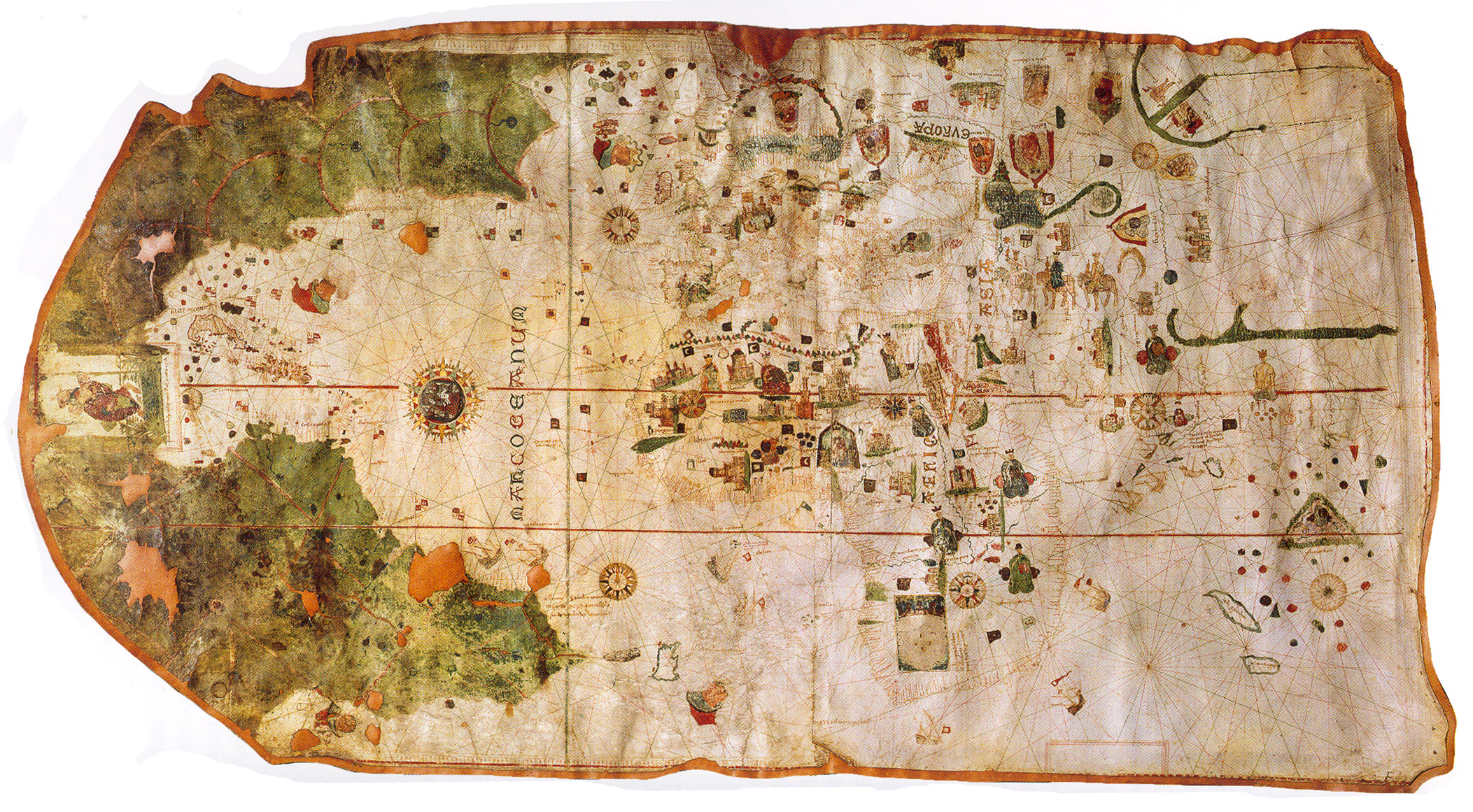
Numa reprodução fac-simile do mapa de 1500 de Juan de La Cosa, colocada no Atlas do Visconde de Santarém, encontramos uma referência singular às Minas de Oz.
As minas de Oz no mapa de Juan de la Cosa (1500)

Já todos ouvimos falar no Feiticeiro de Oz, ainda que não tenhamos visto o filme technicolor de 1939... (irá aparecer em 2011 uma nova série Witches of Oz, filmada no início deste ano).
O filme original é inspirado em toda um série de estórias de L. Frank Baum sobre uma Terra de Oz, devidamente cartografada:
Frank Baum e o seu mapa e bandeira da Terra de Oz e vizinhanças... 

Mas como é óbvio, este texto não diz só respeito ao aspecto ficcional de Lyman Frank Baum, nem da sua revolta perante o massacre americano dos índios Lakota no Wounded Knee Massacre
O texto é sobre a influência submersa que estes eventos foram tendo, e a forma como os nomes singulares acabaram por nos ser transmitidos de forma implícita!

O "non-estic ocean" de Baum aparece localizado em posição semelhante ao Índico no mapa de Cosa... mas é claro que o OZ de Baum sendo abreviatura de Oscar Zoroaster, tem um contraponto na abreviatura OZ para a unidade de massa que é a Onça (aprox. 28 gramas), usada na ourivesaria. Essa unidade de um sistema duodecimal, tinha já aparente expressão na cultura greco-romana antiga, e dela nos restam ainda os múltiplos (arroba=512=29onças, quintal=2048=211onças)  

sexta-feira, 19 de novembro de 2010

Carta do Atlântico Norte

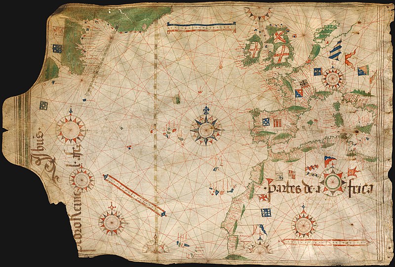
Pedro Reinel assinou uma carta denominada "Carta do Atlântico Norte", que se encontra na Bayerische Staatsbibliothek (Munique), e que foi datada de 1504. A identificação do autor é feita usando a expressão 
"Pedro Reinel a fez",
mas não encontramos nenhuma data. Traduz assim uma mensagem que poderá ser entendida como uma reprodução de uma carta já feita anteriormente. É nossa convicção que poderia ser uma reprodução da Carta presente na negociação do Tratado de Tordesilhas (1494) - todo o enfoque é dado ao Meridiano de Tordesilhas, que aparece representado duas vezes (a segunda representação é mais pequena e está inclinada). Já abordámos a representação do Brasil, rodando o mapa 180º, entendido na parte de território verde... comparado com o mapa de Cantino de 1502, seria incompreensível a não representação em 1504.
Carta do Atlântico Norte, Pedro Reinel (1494-1504?).
O facto mais surpreendente desta Carta não é tanto a presença de terras americanas a oeste, marcadas a verde (à esquerda). O mais surpreendente é a identificação de uma ilha na posição da Dinamarca.
Pedro Reinel, considerado o maior cartógrafo do seu tempo, nunca desenharia a península dinamarquesa como ilha, a menos que houvesse um propósito diferente.
É esse propósito diferente que aqui é debatido... começando por comparar com a carta feita pelo mesmo autor, em 1485, que assinou de forma diferente: "Pedro Reinel me fez", não invocando um tempo passado. Essa carta de 1485 parece ser qualitativamente superior a esta (de 1504?), não havendo aparente razão para a perda de qualidade... nem razão para ser apenas uma carta restrita ao Atlântico Norte, a menos que tal como no outro mapa, uma rotação deste mapa revele algo diferente.

Com efeito, se rodarmos este mapa, e olhando com cuidado, podemos rever os contornos escondidos que estavam no mapa de 1485... embutidos no próprio desenho da Europa, levando a distorções artificiais que colocavam a Dinamarca como ilha. Isso seria justificado num intuito de esconder um mapa da América Central no próprio desenho da Europa, ou como diria Camões nos Lusíadas: "Pado o sabe, Lampetusa o sente". Mostramos uma interpretação alternativa do mapa, projectando a comparação americana, após a rotação. A costa mexicana é comparada com os pontos assinalados a azul claro:

ANÁLISE ESQUEMÁTICA COMPARATIVA:
Costa Mediterrânica de Espanha/França/Itália/Sicília >> Costa do México/Texas/Florida
Costa Atlântica de Espanha/França/Holanda/Dinamarca >> Costa oeste do México e península da Califórnia
Córsega/Sardenha/Baleares <|reflexão|simetria|> Cuba/Hispaniola/Antilhas(Jamaica) 

Esta é apenas uma hipótese interpretativa (discutida há 6 meses com KT - ver aqui), com o devido grau especulativo próprio de qualquer leitura não literal. Aliás de forma surpreendente, podemos mesmo ver semelhanças mais latas, enquadrando o mapa numa dimensão maior, que incluiria por reflexão ainda uma parte ocidental da América do Sul:
ANÁLISE ESQUEMÁTICA COMPARATIVA - extensão por reflexão
- a parte africana é reflectida como uma parte ocidental da América do Sul - zona do Perú.

Esta não se pode considerar uma prova objectiva literal, pois está sujeita a interpretação. No entanto, é claro que se no mapa de 1485 estava implícita informação, ficaria a pergunta se haveria também informação escondida neste mapa posterior. Para além da evidente informação sobre os novos territórios apresentados - normalmente ligados à zona do Canadá/Labrador, esta interpretação permite justificar onde pode estar essa informação neste novo mapa. Adiciona-se a esta observação, a persistência desta representação num mapa posterior de Lopo Homem, de 1550.

quinta-feira, 11 de novembro de 2010

Main Facts (2)

Continuation from Main Facts (1)

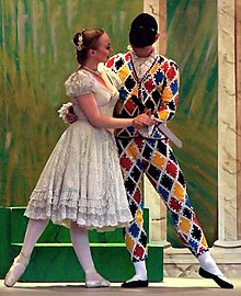
While facing a version of Columbus official History, we may choose to believe in different stories and films. It is well known that, before Columbus, regular voyages to the West were taking place, and the Portuguese knew exactly were Columbus had landed. In fact, King John II set immediately a fleet to the Antilles to prevent a second expedition. The official version has been ridicularized ever since, using an underground style in Art. For instance, the Harlequin, or Pulcinella, and his mistress Columbine (Pierrot's wife) try to tell part of the story, in a 16-17th century Comedy style.

A "Pulcinella secret" is understood to be a secret that almost everyone knows, but nobody acknowledges it... In this Columbine ball, the European courts found an amusing way to exclude the people from the truth. Moreover, in Spain, Pulcinella was also called Don Cristobal Polichinelo. Thus, you have the pair Don Cristobal and Columbine, it is not exactly Don Cristobal Columbus, but it would be difficult to be more explicit.
The Columbine ball.
(Disclaimer: no connection is intended with "Bowling for Columbine")

4. Pizzigano map
The oldest Portuguese chart held by Prince Henry in 1424 reports not only Madeira and Canary islands, but also Azores (only officially discovered in 1432). Moreover it signals as Archipelagos the Antilles in a red rectangle, and Satanazes in a blue one... almost 70 years before Columbus voyage.
In the map below we drew blue lines departing from a center marked in Spain (near Madrid, which was a small village at the time), crossing this blue "Satanazes" rectangle. This opens all directions to New Scotia and Newfoundland archipelagos. Likewise, from the same center, crossing the red "Antilles" rectangle, this leads directions to the same Antilles... that were uncovered (say discovered) by Columbus many decades later.
For sailor, directions were much more important than distances.
Pizzigano map 1424 - West lands: Antilles (red) and Satanazes (blue):
- (our) blue lines - directions to Newfoundland from a marked center in the map. 
- (our) orange lines - directions to the Antilles from a marked center in the map
- (our) blue line - from the "Island Maydas"; (our) pink line - from the "Island Brazil".
The same lines in Google Maps, showing the directions to Newfoundland and Antilles. 

Again, it is just a matter of common sense:
- Officially, since 1432 the Portuguese were sailing to Azores in a regular basis.
- Azores archipelago is almost in the middle of the Atlantic.
- You need much more navigation skills to find Azores in the middle Atlantic than to find America.
- A voyage from Lisbon to Azores would take approximately the same time as a voyage from Azores to Newfoundland.
- It is much more difficult to find small islands in the middle of the Atlantic than to find a huge continent like America, unless we admit a persistent navigation to the West.


Why is this is not being told?
... Well, it may be a ball, but we were not invited to dance, we are here to serve.

5. Anian Strait or Bering Strait
In the late 1597 the Portuguese cartographer Lavanha started a map that he called "Theatrum Mundi"... this is a good title, as Shakespeare plays were starting at the time.
Lavanha's map c. 1597-1612 (see full map in Theatrum Mundi)


This map is quite precise, except if you look at the bottom part, which may represent the Antartica continent (however, Australia seems to be always missing).
The most astonishing thing in this map is the precision with which the northern part of America is represented, suggesting that the Northwestern Passage, officially only discovered by Amundsen in the 20th century, was already known (at least 300 years before).
The Bering Strait is represented exactly, but since Vitus Bering would only be born almost 100 years later, it was then called Anian Strait. The map is much more precise than a 1570 Ortelius map, that also presents an Anian Regnum at the Strait location.

- What do people say about this?
Nowadays - nothing! In fact Portuguese navigations are kept hidden from almost every foreign course on History... sometimes people mention Prince Henry or that Columbus lived in Portugal. 
This map is found in a huge collection called Portugaliae Monumenta Cartographica (1960), and you would expect to see some words about this there... well, you do not see anything, except some words concerning the history of the map itself, and its date. 
It was dated between 1597-1612, and this would justify the presence of the Davis Strait (1587, however the handwriting is different), Nova Zemla uncovered in 1597, Hudson Bay (1611), but not the Baffin Bay (1616), not to mention the whole northwestern and northeastern passages.

What did people say about this... in the past?
We cite the Portuguese mathematician Pedro Nunes in 1537:
"There is no doubt that the navigations of this kingdom, in the last 100 years, are the greatest, the most wonderful, most higher and discrete than any other people in the world (... The Portuguese) lost their fear so much that they went to the hottest places in the torrid zone and to the coldest places in the extreme south (...) And they made the sea so flat that today nobody dares to say that he discovered again some small island, some banks, or even cliffs, that were not previously discovered by our navigations".


Pedro Nunes died in 1578, the same year King Sebastian died in the Battle of Alcazar (this fact lead Portugal to be a part of the Spanish empire during 80 years). This foreign tragic event lead to one of the first English plays, by George Peele called The Battle of Alcazar (before Shakespeare's plays).


We are led to think that it would be quite difficult to produce an accurate map in frozen seas in the 16th century. Thus, we also present a detail of the so-called Cantino Map (Cantino was an italian spy, that sent a map to the Duke of Ferrara in 1502). This map presents Greenland with the most astonishing precision in 1502 (Corte-Real went there in 1500):

Greenland: in Cantino's map (1502); on the right: in Google Maps.

6. Hierusalem with a portuguese flag
We find in a map by João de Lisboa, a strange detail - a Portuguese blue flag in Jerusalem.
Detail in a map by João de Lisboa (c. 1514, Livro de Marinharia)

In the 12th century Crusades, the Kingdom of Jerusalem was conquered by King Baldwin, but it was then soon lost to Saladin (1187). From that date until Napoleon's short incursion into Palestine, and before the Balfour declaration (1917), it was never reported any other conquest.


However it is clear that this flag is not a coincidence.
It is known that Afonso de Albuquerque lead a huge war effort in the Red Sea, conquering even Suez (near the channel). When he was deposed by King Manuel, sending a new Vice-Roy to India in 1515, it is reported that he was intending to conquer Mecca from the Mamluks, and ask in exchange the Holy Land - Hierusalem. 
Albuquerque is reported dead in 1515, in “grief with the replacement”... Soon afterwards, in 1517, the Ottomans defeat the Mamluks and assume the control of Jerusalem.


- What did happen? Are we allowed to guess?
We cite part of a message sent by the Shah of Persia, Ismail I (just before the battle of Chaldiran), to the Ottoman Sultan Selim I, in 1514:
  I know the Truth as my supreme guide,
  I would sacrifice myself in his way,
  I was born yesterday, I will die today,
  Come, whoever would die, here is the arena


As we know, Ismail was not the only one defeated in a battle in the name of Truth… 


(to be continued)

sexta-feira, 5 de novembro de 2010

Dra-co-la (cola del dragon)

Retomo o tema da Cola do Dragão, a que os espanhóis chamam La Cola del Drágon, o que significa "Cauda do Dragão". Na versão inglesa anterior coloquei o termo "Dragon Cola", por não me parecer clara qual a melhor tradução... só o significado espanhol de "Cauda" para "Cola" parece apropriado (na idade moderna, no português, esse significado deve ter-se perdido).
No entanto, nem é claro que essa Draco-Cola (usando uma versão latinizada) fosse exactamente o Estreito de Magalhães... conforme podemos ver no mapa seguinte, quer a parte sul da América, quer a península que emerge da Antártida têm um aspecto que justificaria o nome "Cauda de Dragão".

É claro que a contracção do termo Draco-Cola leva a Dracola...
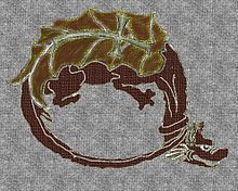
O célebre personagem de Bram-Stoker era inspirado em Vlad III Dracula, cujo pai em 1431 teria aderido à Ordem do Dragão (criada pelo Imperador Sigismundo em 1408). A presença do mapa antigo, do Infante D. Pedro, que teria a referência à Cola do Dragão, é de 1428, de acordo com o relato do séc. XVI de António Galvão. Reparemos num dos símbolos da Ordem do Dragão:
Insignia da Ordem do Dragão

Podemos comentar o pormenor curioso de na Insígnia da Ordem do Dragão, a Cauda fechar, amarrando o pescoço. Há muitas maneiras de representar dragões, mas não com esta utilização da Cauda... isto dá um sentido seguro na designação Draco Cola se referir à cauda. Notamos ainda que há uma folha nas costas do dragão que poderia passar por um mapa da América do Sul, com uma cruz. O combate da Ordem do Dragão seria para manter esse círculo fechado, amarrando o dragão americano... talvez o medo de que o sonho americano se tornasse num pesadelo de políticas draconianas.

As curiosidades não ficam por aqui... para além de Luís de Camões e Ana Mendonza de La Cerda, também Oswald von Wolkenstein, um poeta viajante que participou na tomada de Ceuta, teve essa particularidade de ser zarolho direito. Foi nomeado ao mesmo tempo que Vlad II Dracula, em 1431, para a Ordem do Dragão. (*)
.. ..
Caolhos direitos: Camões, Ana de La Cerda, Wolkenstein

Sobre a história malfadada de Bram Stoker, sobre o mais famoso membro da Ordem do Dragão, o Conde Drácula... a sua ligação a vampiros, enquanto elite supra-humana que se alimentaria do sangue humano para manter a sua imortalidade, tem assim um significado próprio! É difícil perceber se haverá um lado mau ou bom, no meio de toda esta história vampiresca... A cauda do dragão foi solta, e o sonho americano libertou-se para a descoberta europeia. Por outro lado, de acordo com a fábula de Stoker, muito popularizada na Inglaterra imperial, esses vampiros da ordem draconiana, apesar de mortos ainda existiriam nas remotas paisagens da Transilvânia. Restou-nos uma efabulação permanente e as políticas draconianas.

______________________________________________
(*) Nota (10.07.2016):
Suprimi uma frase acerca de uma sugestão na Wikipedia, entretanto retirada:
Acrescenta-se a isso o facto do Infante Dom Pedro, pelos seus serviços ao Imperador Segismundo, ter sido nomeado membro da Ordem do Dragão, tendo usado a sigla DESIR que significaria (sugestão na wikipedia)
D.E.S.I.R.: Draconis Equitas Societas Imperatur et Regis
Sociedade Imperial e Régia dos Cavaleiros do Dragão
Como foi notado entretanto (ex: David Soares), este acrónimo não parece corresponder a nada existente sobre a Ordem do Dragão, cujo nome em latim seria Societas Draconica seu Draconistarum, e assim pode ser algo simplesmente inventado para ligar à divisa DESIR. 
No entanto, penso que uma ligação de Avis à Ordem do Dragão faz sentido, quer pela participação de Wolkenstein na tomada de Ceuta, quer pela recompensa de Treviso, que o Imperador Sigismundo fez ao Infante D. Pedro.
______________________________________________

domingo, 31 de outubro de 2010

Main Facts (1)

First thing: Common Sense
... to believe or not the Official "Columbus" Version?
Official dates for the discoveries (1434-1500)

Official facts:
1434-1488: Hundreds of navigations, first lead by Prince Henry "the Navigator" arrive to Sierra Leone, then lead by King John II, arrive at Congo, and at most at Cape of Good Hope (South Africa). Not a single voyage to the west... excluding the regular voyages to Azores (<1432), in the middle Atlantic.
1492 - A single voyage lead by Columbus, from Cadis arrives at the Antilles.
1498 - A single voyage lead by Gama, from Lisbon arrives at India.
1500 - A single voyage lead by Cabral, from Lisbon arrives at Brazil.
1500 - A single voyage lead by Corte-Real arrives at Greenland and Newfoundland/Labrador.

After the Tordesillas Treaty (1494), when the Pope divided the world between Portugal and Spain, King Manuel set the limits of his Hemisphere - on the north: Greenland/Labrador, on the south: Brazil, on the east: India. When he took power within 3 years (1498-1500) he uncovered... say "discovered", his part of the deal.

Why? - well, of course... the main stream version:
- People believed that the Earth was flat... of course, and surely they were falling while crossing the Equator, while Columbus was still a child. They were then enlightened by Columbus... LOL!
- The main stream version is quite nice as a joke like "Columbus egg" - it is so obviously false, but people are lead to believe in what they are told.

Why are we led to a wrong version? - don't ask me, although I have my answers (which are not nice)!

Map of the discoveries/possessions in 1515
King Manuel with Almeida and Albuquerque set the Indian Ocean as a Portuguese ocean, expelling the turkish domination and arrived to China (1515). At the same time the turks were invading eastern Europe, assaulting the fleets in the Mediterranean sea, the Portuguese were menacing Mecca, and conquered Suez.
The spanish Emperor Charles V was consolidating a considerable small domination in the Mexican Gulf, while the portuguese were establishing the biggest naval domination in History, as we may see in this map:
Discoveries until 1515. Portuguese (blue dots), Spanish (yellow dots).

Despite the portuguese arrival at Timor in 1514, Australia was only discovered by Cook in 1770... of course! - It makes a lot of sense, and all those that tried to prove otherwise had some trouble in publishing the proofs.

Well, since (almost) all maps before 1500 disapeared, it is time to present some main contradictions that have been left behind. 

1. Turning a Reinel Map (1485)
Reinel's map of 1485 was found in a library in France, only in 1960. Some people tried to date it after 1500, however there is Moorish flag in Granada, that only fell in Spanish hands in 1492, the year Columbus departed... This is only inconvenient if you turn the map around, since you might see a nice Central America contour, some years before Columbus voyage...
Surely this is just a remarkable coincidence... as this knowledge would only be possible according to the official version, until at least 50 years after. Is it so?

2. Map of part of America - João de Lisboa (died 1525)
In a partial map of central/south America, João de Lisboa decided to put some Portuguese (and moorish) flags in Peru/Colombia... however since the spanish Pizarro expedition to the Incas occurred in 1529-32, this is also an inconvenient map. Despite the book where these maps are, called "Livro de Marinharia", was signed by João de Lisboa saying "made in 1514", the official cartography dates this as 1560... after the author was dead! Even so, this does not justify Portuguese or Moor castle in the Incas territory. 
A map by João de Lisboa, in a book signed 1514.
(magenta squares show the portuguese/moor flag castles)

This is also a complementary proof to the Duchess Medina-Sidonia theory that the Moors were sailing to America before the Spanish... This was presented in the 500 anniversary of Columbus arrival, but kept aside from the general public! We believe that a Portuguese castle was the Castle of Saint George of the Mine - confusing itself with a similar name of a fortress in Africa. This was a general strategy - mixing african and american names.

3. Map of the World - João de Lisboa (died 1525)
In the same book by João de Lisboa, we find a remarkable world map:
World map by João de Lisboa, in a book signed 1514.
(yellow triangle is to be skipped and glued by the blue line spots)

Even if we accept the 1560 official date, this maps shows a very good world map, superior to most maps until Cook (1770). It has a contour of the western part of North America, that was "not allowed" after 1600... the contour does not close America to Asia, assuming an opening at the Bering Strait (Bering was born in 1680).
This map could never been dated to 1514, because it also shows the Magellan Strait, only crossed in 1521, and Japan, only uncovered in 1543. Unlike any other map around 1560 it does not mention the Magellan Strait, only the Cape of Good Hope... this is now justified, also Galvão (a portuguese hero of the XVI century) reports there were maps signaling Magellan Strait around 1428 - at that time it was called Dragon Cola (Dragon's Tail).
Furthermore, all small flags in this map are perfectly justified in a 1514 map, but not afterwards - for instance, Albuquerque conquests of 1515, in the Arabian peninsula, are not signaled.

(... to be continued)

sábado, 30 de outubro de 2010

Matusalém e Santarém

No blog Portugalliae, há mais de um ano, foi evidenciada a complexidade da cerâmica encontrada na Civilização de Santarém (no Brasil) e Alter-do-Chão (também no Brasil...). José Manuel indicou ainda um artigo do Science Daily que revela as surpresas dessa Terra Preta do Índio.

Regressemos a Santarém, mas em Portugal...
Em vários blogs escabilitanos encontramos a chamada "Lenda de Abidis" (por exemplo, aqui ou aqui), em que se fala do Rei Gorgoris (que teria o cognome Melícola, por ter recebido dos deuses o segredo do mel), da sua filha Calipso e do filho que esta teve com Ulisses de Ítaca. Esse filho era Abidis, recolhido por uma loba (ou cerva), num local onde aí  fundou a cidade Esca-Abidis (manjar de Abidis), de onde viria o nome romano Scabili-castrum (castelo de Abidis). A variação e contracção faz-se de abidis para habilis. É ainda interessante a semelhança do mito de Abidis com a história de Rómulo e Remo, também alimentados por uma loba. Já aqui falámos dessa tradição mítica nacional associada a Noé e a Tubal, que fazia parte de qualquer história nacional, até ao século XVIII, e depois de Alexandre Herculano nem tão pouco sobreviveu como mito.

No entanto, esta Esca-Abidis acabou por permanecer Santarém.
Não longe de Santarém, há antigos registos romanos que situam Matusarum ou Matusalum
Não se chamava Matusalém, mas sim Matusarum... Duarte Nunes de Lião (séc. XVI) na sua Orthographia explica esta subtileza... os portugueses consideravam mais másculo o som do "R" em vez do "L", e por isso ao contrário de várias línguas, fizemos variações em que desapareceu o L: - em vez de "doblar" passou a "dobrar", "plaga" passou a "praga", etc... (pag.26 da Orthographia).
Fica aqui notada essa existência romana de Matusarum, próximo de Ponte de Sôr, num local que será agora Foros do Arrão, perto da barragem de Montargil. Prosseguindo na mesma direcção encontramos Alter do Chão, a portuguesa... a chamada terra do cavalo lusitano.

Matusalém seria, de acordo com o Genesis, o homem com maior longevidade, filho de Enoque e avô de Noé, o ano da sua morte teria coincidido com o Dilúvio.

Mais uma vez vamos encontrar o registo mítico bíblico associado à Hispânia, neste caso próximo de Santarém. Cidade que contava com uma especial atenção real, na época dos descobrimentos, nomeadamente por D. João II, e que é bem conhecida pelas suas Portas do Sol, viradas a nascente.
Santarém - Portas do Sol
É claro que as muralhas existentes no parque das Portas do Sol são bem mais recentes que outras Portas do Sol, como a de Tiahuanaco, ou tantas outras notáveis civilizações americanas pré-colombianas...
Tiahuanaco - Porta do Sol
No entanto, não deixa de ser interessante ter-se mantido este conjunto de mitos, e associações, numa cidade situada numa colina sobre um Rio Tejo navegável.

Centum Cellas (por Calisto)

A propósito de Egitânia, é de recordar o texto sobre Centum Cellas num antigo comentário por Calisto, que deveria ter aparecido como post na altura, ilustrado com algumas figuras.

Torre de Centum Cellas

Sobre Centum Cellas vou tentar ser sucinto. Das poucas escavações que por lá se fizeram (presumo que Aurélio Ricardo Belo), é de registar um pote de barro com ossos de criança calcinados.


Sem avançar nas explicações técnicas a existência de rasgos para encaixe de aros nas 3 janelas cimeiras que dizem respeito a um terceiro andar levam a colocar fora de dúvida a adaptação do edifício primitivo, a funções diferentes daquelas para que foi construido.


Origem de enormes furos que atravessam as paredes laterais e a do fundo, que alguns autores tomam como portas pode-se prender com a lenda da existência de um boi de ouro enterrado...logo andaram uns poucos à procura do dito boi.


As ruinas situam-se a 11km em linha recta do cabeço das Fráguas.

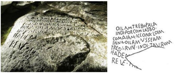
Inscrições em Cabeço das Fráguas

A zona tem possantes jazigos de cassiterite, e o Zêzere descrevia uma curva de maior amplitude do que aquela que agora descreve "(...) recebia a ribeira da Gaia no sítio dos Catraios, em frente a Centum Cellas (...)"


Edifício composto de um nucleo com anexos ligados às paredes laterais. Núcleo tinha 2 pavimentos os anexos 1. A planta do conjunto é rectangular e este era absolutamente simétrico a 1 plano axial.
Fachada principal virada para o nascer do sol nos maiores dias do ano.


Nas ombreiras de todas as portas do R/ch, há rasgos horizontais, junto das vergas, onde se encaixavam os tabuões. As portas giravam sobre 2 espigões fixos. Rasgos semelhantes existem nas ombreiras de vão de portas de certos templos do antigo Egipto.
Ignora-se o significado das 3 janelas rectangulares e desiguais (vê-se na foto que incluiu no artigo) que assentam nas vergas das portas exteriores, em Efeso a pia baptismal tem um grupo de 3 rectângulos que dizem ser símbolo da trindade...

Éfeso: pia baptismal

De acordo com o autor, Vitrúvio não aplicou a secção dourada e não refere na sua obra Arquitectura, se a conheceu, guardou segredo.
Das relações geométricas, vou deixar 2 ou 3 apontamentos para não me tornar muito extenso.
  • Sala do 2º pavimento (abrangia totalmente o 2º pavimento e cujs aberturas davam para uma varanda que a contornava, provavelmente o motivo principal do edifício). Parede (que se vê) que fica à esquerda na foto, composta de porta pequena, janela, porta grande, janela, porta pequena. Portas menor dimensão: a relação entre as 2 dimensões (altura, largura)é a dimensão da planta do partenon (rectangulo do partenon), a razão entre a diagonal e o segmento que une um dos vértices ao ponto médio do lado maior, oposto, é igual ao número de ouro.
  • A parede de topo que aparece na foto de frente (1 porta de maior dimensão ladeada por 2 janelas que parecem quadradas):o arquitecto procurou inscrever 2 secções douradas, justapostas pelos lados menores, num rectangulo de comprimento igual à largura da sala e altura igual à distancia que vai do pavimento às vergas da janela, a mesma em 12 vãos da sala. Porem para manter a medida de 2,18m e conservar a razão entre as 2 dimensões da secção dourada perfeita, o arquitecto foi obrigado a aumentar ligeiramente o lado maior destas. Assim este lado ultrapassa, de perto em 11mm , a metade da largura da sala. Na grande piramide de Gizé existe um corredor com 2,18m de altura. Mero acaso?
Tudo o que escrevi (e muitas mais relações, realmente impressionante) encontra-se no livro que referi, o que achei notável e fascinante foram as relações arquitectónicas/geométricas que o autor encontrou. Desculpe a extensão, mas foi a forma que encontrei para mostrar que as relações realmente existem.


Autor: Calisto (texto em comentário sobre Brito Bluteau, com algumas ilustrações incorporadas)

domingo, 24 de outubro de 2010

Egitânia

Egitânia era o nome dado pelos suevos e visigodos à população de Idanha, significativamente diferente do que permaneceu, e ainda do romano Civitas Igaeditanorum. O novo acordo ortográfico tem destas surpresas no sentido oposto ao objectivo de perder ligação às raízes das palavras...
Agora devemos escrever Egito, e se Lusitânia deriva de Luso, pois Egitânia parece agora derivar de Egito...
Surge este texto a propósito do comentário[de Maria da Fonte] que fala do achado de um escaravelho egípcio numa escavação arqueológica romana em Alcácer do Sal, da época do faraó Pasmético (sec. VII a.C).
Pode sempre dizer-se que se tratou de uma peça trazida do Egipto, na altura romana... sabendo-se que encontrar o obelisco na Place Concorde também não significa que os egípcios tenham estado em Paris. Aliás, pela mesma ordem de ideias, encontrar as pirâmides no Egipto, também não significa que tenham sido feitas pelos egípicios... poderiam apenas ter sido transportadas (afinal, as pedras nem são originárias das redondezas).
Quando falamos de registos históricos, temos que guardar a devida distância de certezas...

Voltando a Egitânia, na Idanha portuguesa, encontramos alguns registos interessantes.
Estão a céu aberto algumas inscrições em pedras significativas:

umas parecerão mais romanas que outras... mas é já de alguma forma habitual o pouco cuidado que se tem na preservação destes registos. É significativo o registo monumental, de várias origens em Idanha, incluindo uma igreja visigótica que parece ter tido várias fases de construção. Várias fotos interessantes podem ser encontradas, e incluem uma estrada antiga (romana... certamente, como é suposto serem todas as estradas antigas!), uma denominada "torre templária", uma casa com a cruz de cristo , etc...
A entrada de Idanha-a-Velha é uma construção maciça com notáveis enormes pedras, que também parecem ter origem em tempos de diferente reconstrução (figura à esquerda), bem como um típico arco "episcopal" (à direita).

Apresentamos ainda uma ponte com um arco diferente, que procura ser mais triangular, característica partilhada com a porta lateral da catedral episcopal (de tal forma pronunciada, que passa o telhado).
Idanha (que não dista muito de Cento Cellas) é apenas mais um dos vários casos em que houve necessidade de haver uma Nova e uma Velha, sendo próximas neste caso, às vezes chegam a estar separadas por centenas de quilómetros, como é o caso de Montemor...